Finally, we were able to disembark at a planned Chilean port and go on our scheduled tour.
Puerto Montt was on Mar 13th. It started out as a very foggy damp day. The area is surrounded by volcanoes, several active and recently erupted. But the fog obstructed views of the volcanoes.
We were on a private tour we booked with Denis of http://www.puertomontt-excursiones.com/. Excellent guide names Danilo for our group of nine.
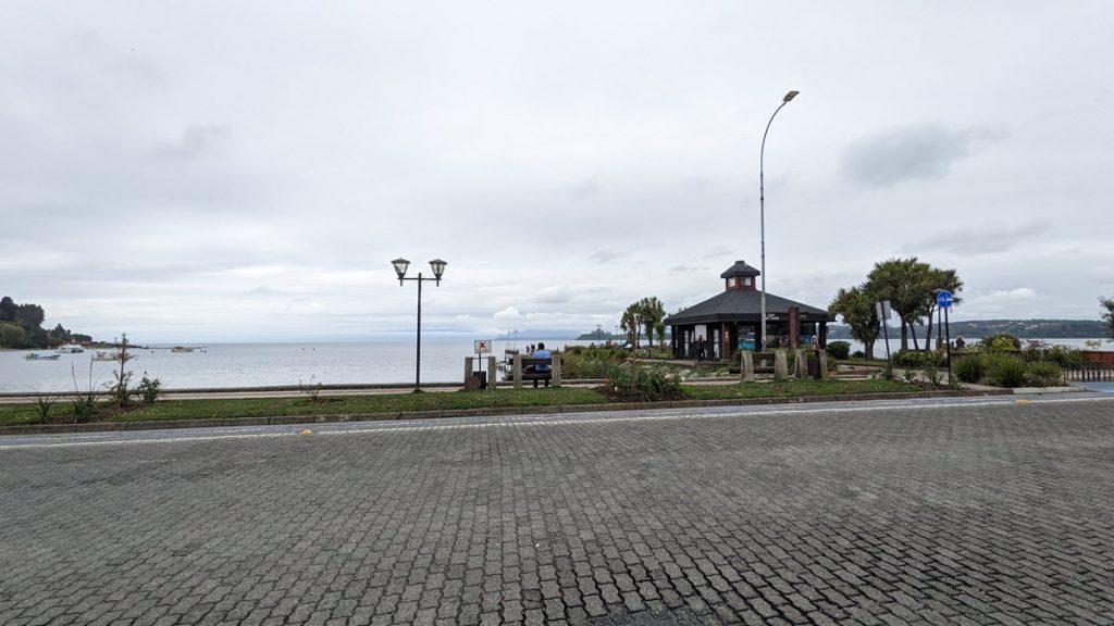
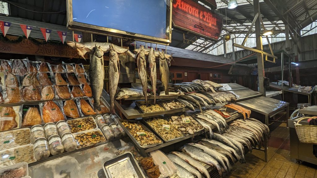
Puerto Montt is located in the Lake district of Chile in Patagonia and is the capital of the region with a population of 300,000. It is an important industrial port especially for the salmon farming. There is a Chilean Navy prescence here and we saw two of their little submarines in port. The weather is typical in this region where it rains 180 days a year. Rainy place.
The people are a mix of Spanish, German and native Mapichu heritage. German immigrants were encouraged to settle in this area in the 1850s and they founded his town of Puerto Montt on the Gulf of Reloncavi. By 1900, 30,000 Germans colonists had cleared the native forests, planted crops and created small towns.
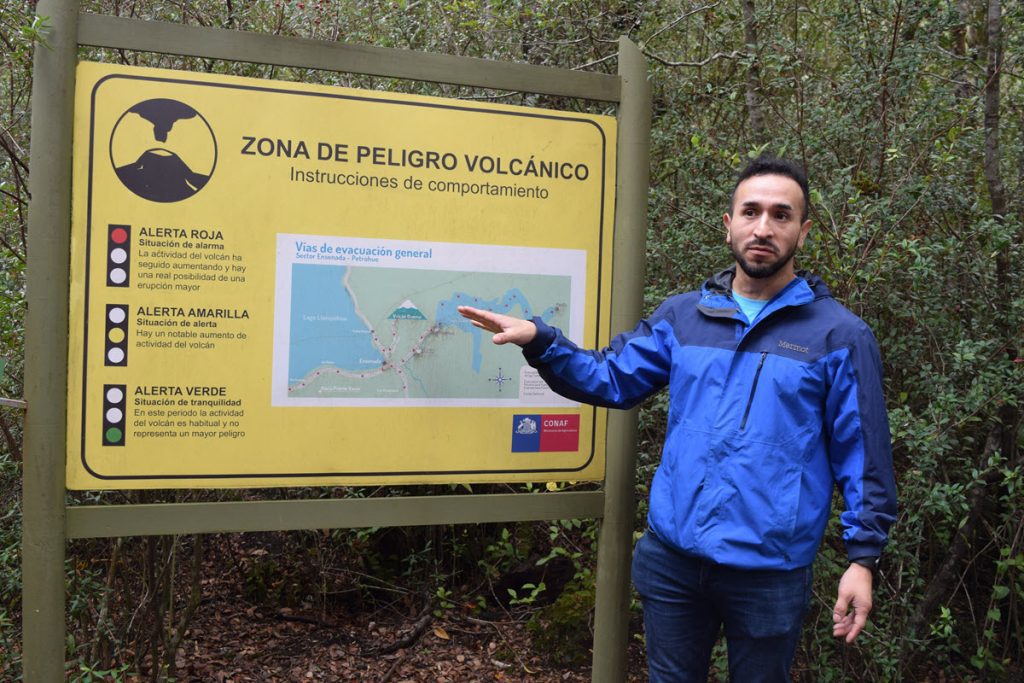
This region is very seismic being part of the Pacific ring of fire. There are four active volcanoes that surround Puerto Montt. The last eruption was in 2015 when Mt Calbuco erupted in April 2015. The weather did not permit any clear views of the Osorno Volcanoe.
We drove around the Southeast quarter of the massive Lake Llanquihue. It is the fourth largest lake in South America covering 877 square km. We visited a couple of national parks outside of town. At the first we took an easy walk to see the Laguna Verde. Puerto Montt marks the southern end of Chile’s Lake District (which starts south of Santiago).
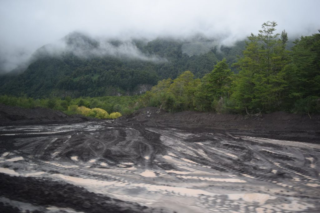
On our way to see Petrohue Falls inside the Vicente Perez Rosales National park, we came up on a huge mudslide. The heavy rains that had prevented our port stop in Chacabuco had washed volcano ash and mud across the entrance to the park. Bulldozers were clearing a lane but warned us that they would leave at 2pm and to be back by then.
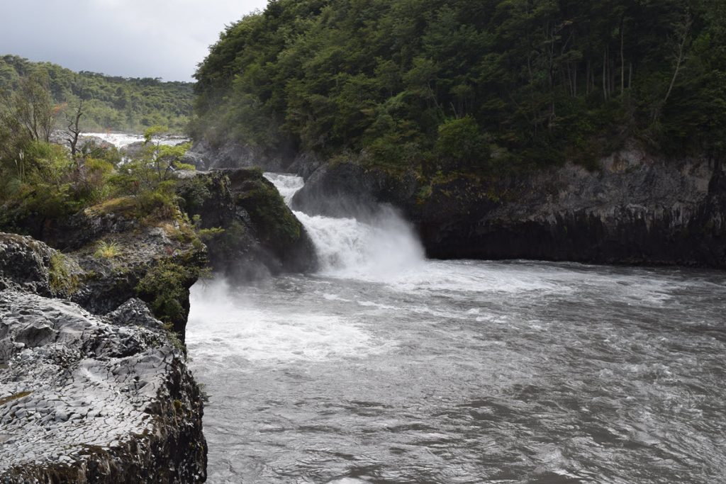
The waterfall was worth the stop and we were lucky to see the sun peep out. I snagged some Chilean stamps on my always elusive hunt for stamps, cards and a mailbox.
The other highlight of the day was a stop in the town of Puerto Varas on the lake. Puerto Varas is a charming lakeside resort town with a German feel to it. We had lunch at Las Buenas Brasas. I tried a local fish haque which was excellent as well as a strong Pisco Sour and a Carmenera Chilean wine which suits my taste.
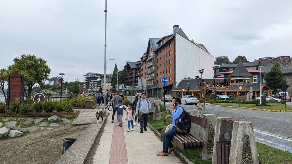
Back in Puerto Montt we browsed the seafood and craft market near the port and I found a little store selling the Carmenera wine.
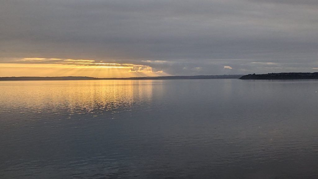
And finally a ray of sunshine at sunset from the ship after many days of damp and rain.
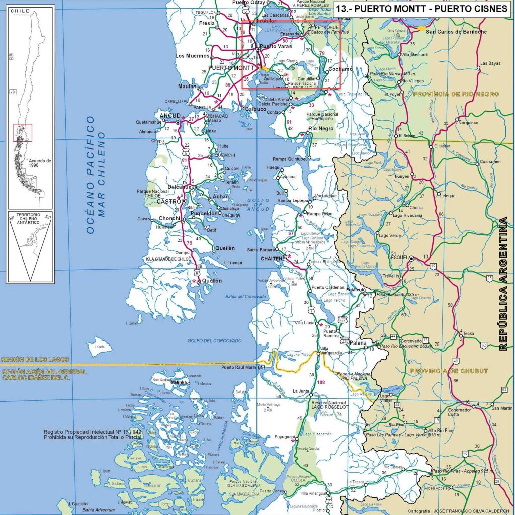
Maps of Region and our Shore Excursion
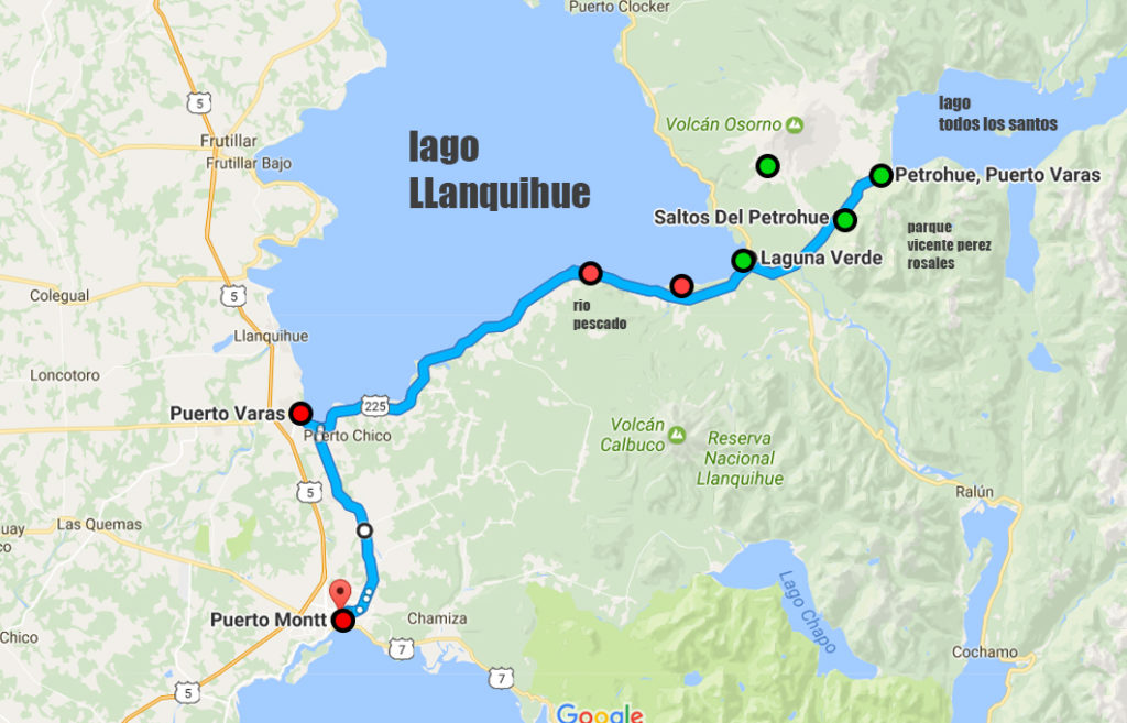
The larger map below shows the larger region where Puerto Montt and the lake are located. The red box is the same as the above map of the drive we took. It took several hours for the ship to get out of the bay where we were docked and then we navigated a very narrow channel at Chacao to get out to the Pacific Ocean. I was getting into my pajamas with doors and curtains open and noticed that there were lights on boats and land very close to the ship!